ONE MAP.EVERY SIGNAL.MORE GOLD.
Other apps give you a hillshade and a hunch. Dig Here stacks ultra high resolution LiDAR terrain, 2.2 million+ drill assays, 2.5 million+ flow-directed watercourse segments, geophysics, geochemistry, and 160 years of mining history onto one map. Then our prospectivity pins mark where the evidence agrees. Available across Australia and New Zealand.
This is the platform the mining companies would build. Priced for prospectors.
Free plan available. No credit card required.
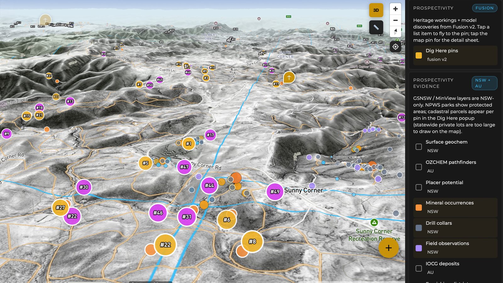
How Dig Here Works
SEE THE GROUND.
READ THE EVIDENCE.
KNOW WHERE TO DIG.
Finding gold is a three-part problem. Most apps solve part of one. Dig Here is the only platform that fuses terrain intelligence, hard evidence and prospectivity targeting into a single map - solving all three.
Pillar 1 · Terrain Intelligence
SEE WHAT 160 YEARS
OF PROSPECTORS COULDN’T.
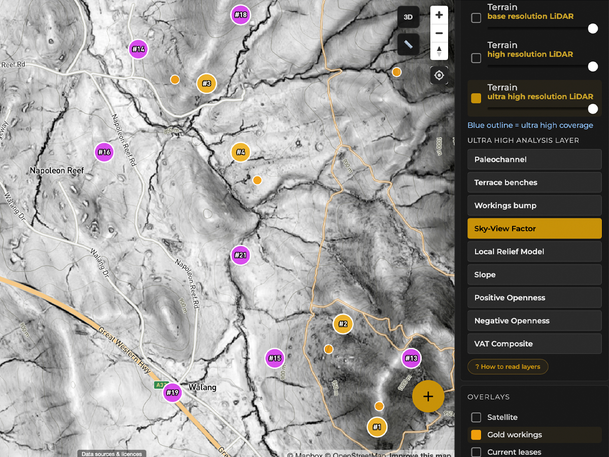
Three tiers of LiDAR terrain across Australia and New Zealand. Tasmania, ACT, and New Zealand are fully covered. NSW is over half done. QLD, VIC, and SA are in progress with new tiles going live every day. WA and NT are on the roadmap. Even 1m high-res is not enough to read old workings clearly. Our ultra high resolution strips away every tree, every blade of grass, and shows the ground exactly as it is. Then 9 specialist analysis layers reveal buried river channels, terrace benches, old workings, and every gully where gold settles.
Other apps sell a single-angle hillshade as a paid extra, state by state. We include an entire terrain analysis lab.
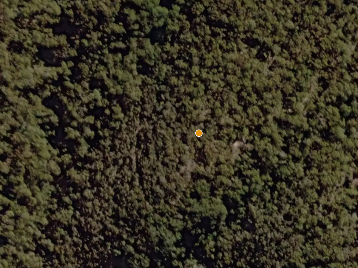
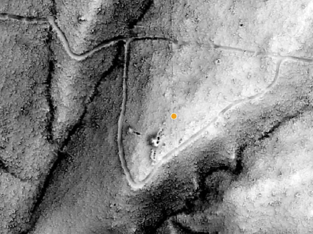
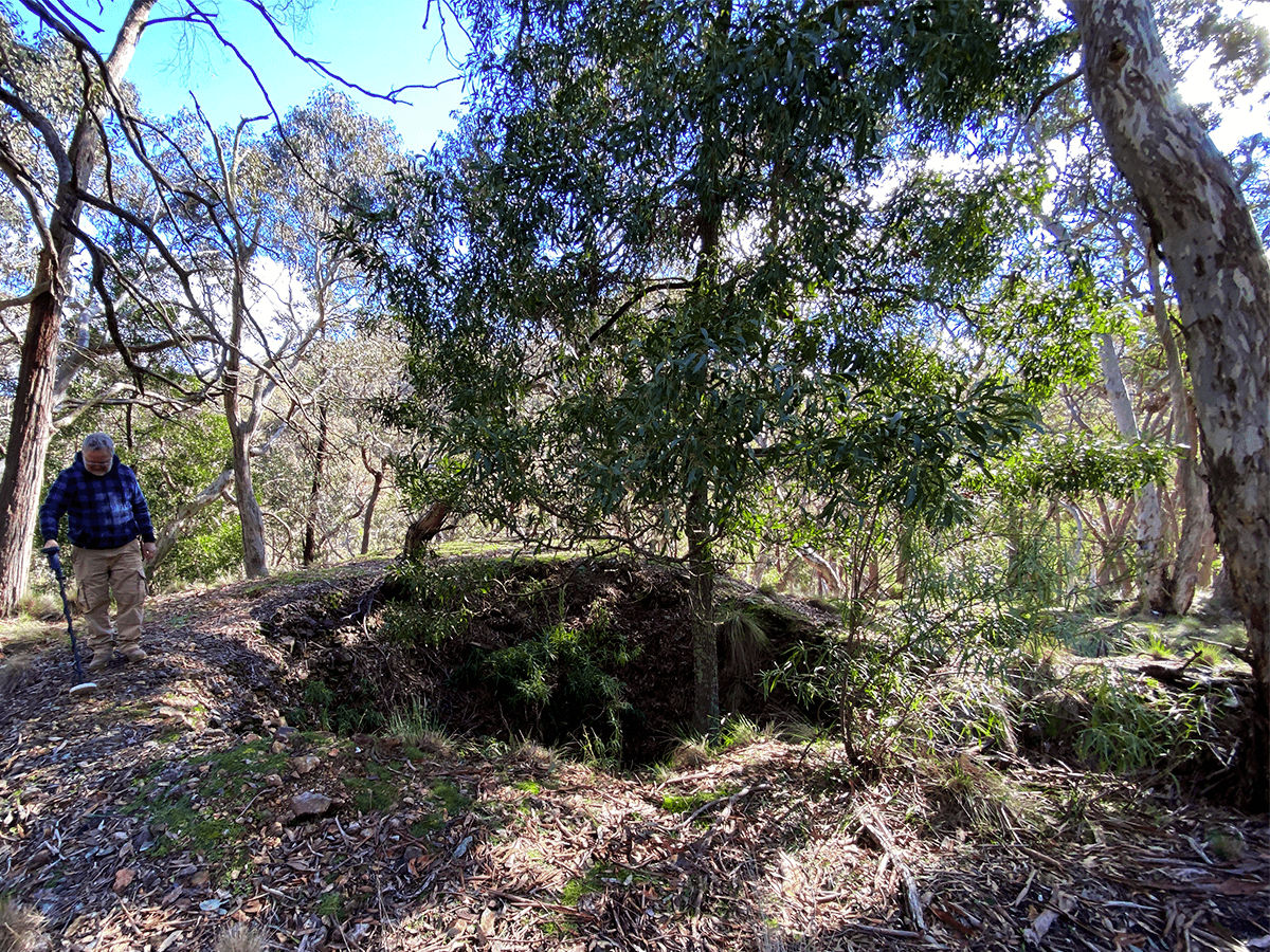
Paleochannel
Ancient buried river channels. Where the old gold-bearing gravels ran.
Terrace benches
Elevated remnants of old riverbeds. Classic alluvial gold ground.
Workings bump
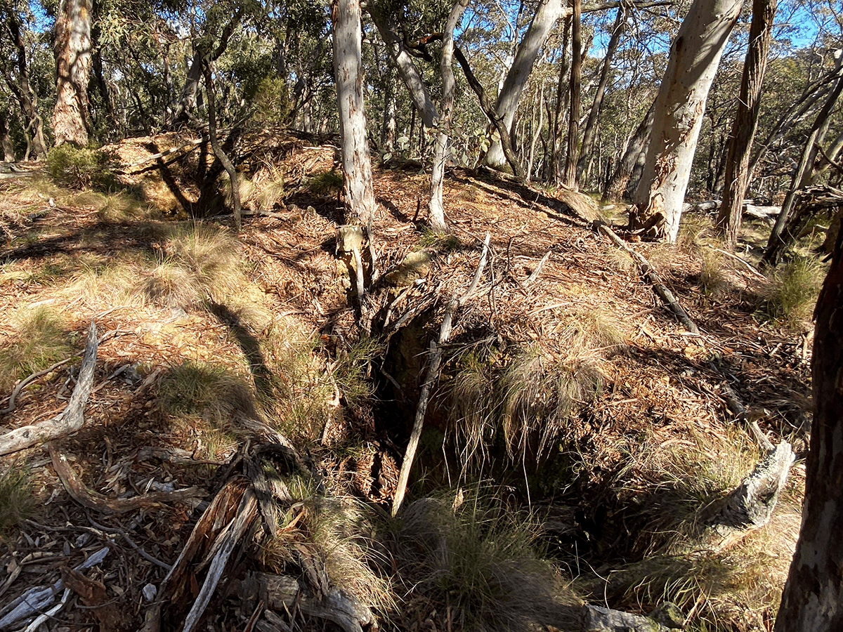
Surface disturbance mapping. Every mullock heap and filled shaft stands out.
Sky-View Factor
Depressions and diggings leap off the screen. No shadow direction to miss.
Local Relief Model
Strips away the hills, keeps the detail. Micro-relief the eye can't see on foot.
Slope
Instantly read gradient. Find the breaks where gold drops out of flow.
Positive Openness
Ridges, spurs and exposed reef lines highlighted.
Negative Openness
Gullies, channels and shafts. The concave ground where gold settles.
VAT Composite
Archaeology-grade visualisation blend. One layer, everything visible.
Pillar 2 · Hard Evidence
STOP GUESSING.
READ WHAT’S ACTUALLY IN THE GROUND.
Terrain tells you where gold could settle. Evidence tells you it’s actually there. Dig Here layers the datasets that exploration companies pay six figures to compile, over the exact ground you’re standing on.
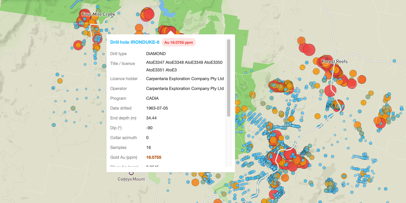
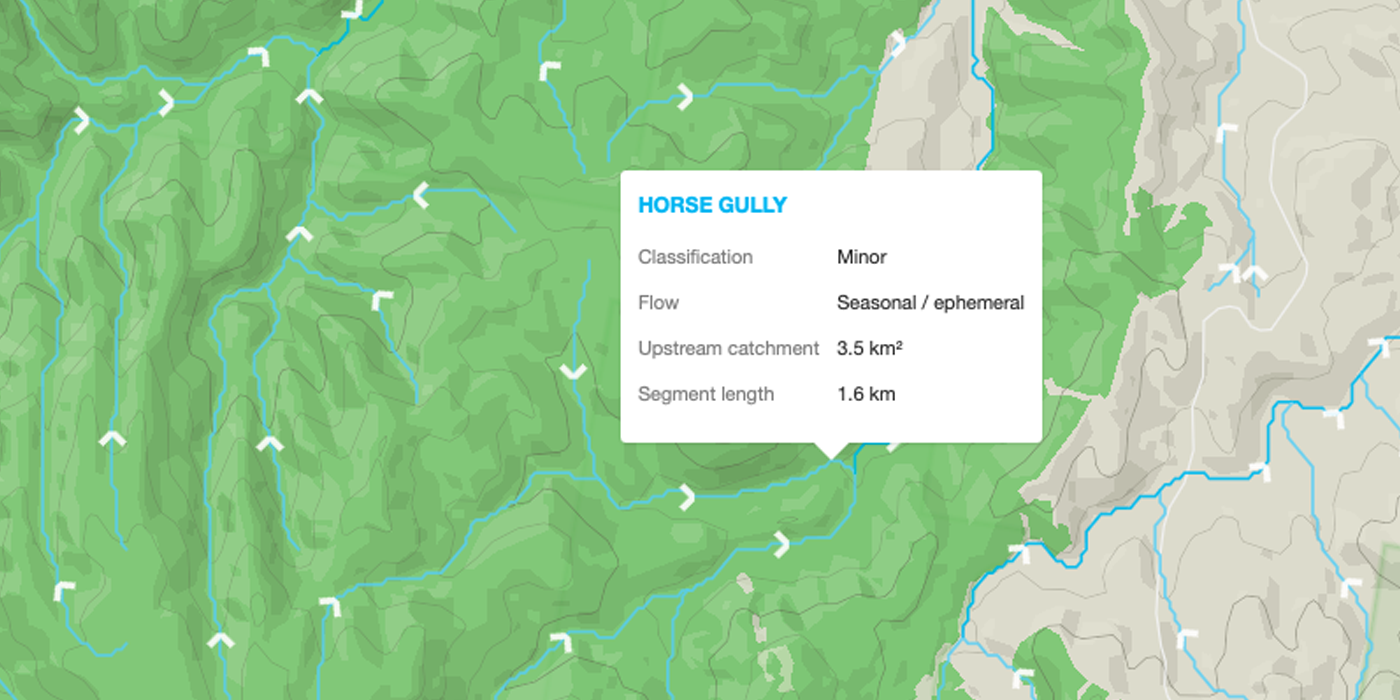
Gold follows water. Alluvial deposits accumulate at bends, confluences, and where the gradient changes. Our watercourse layer shows 2.5 million+ stream segments across every state and territory, with arrows showing exactly which way water flows downstream. Perennial waterways show in bright blue. Seasonal and ephemeral streams - the dry gullies that only run after rain - show lighter. Those dry gullies are often the most productive ground, because that is where alluvial gold concentrates as water recedes. Click any stream for its name, flow type, catchment area, and segment length. Overlay it on LiDAR terrain, historic workings, and geology, and you can trace drainage patterns straight to where gold is most likely sitting. No other prospecting platform offers flow direction on watercourses.
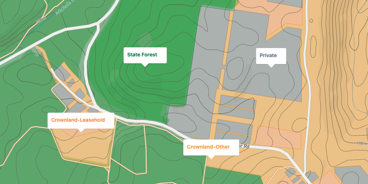
Land tenure answers the question the map cannot: are you actually allowed to dig here? Before you load the ute and drive two hours, the tenure layer shows Crown land, private property, National Parks, state forests, and every category in between. In New Zealand, DOC conservation land is mapped with national parks, conservation areas, reserves, and marginal strips, plus 722 active mining permits and 19 designated Gold Fossicking Areas. Every prospectivity pin also checks tenure automatically and tells you in plain English whether fossicking is permitted.
Drill hole assays
2.2 million+ real assay results with gold grades in ppm. See exactly what the exploration companies found, and precisely where they drilled it.
Geophysics
Gravity, magnetics, radiometrics and mineral potential rasters. The same data mining companies pay geophysicists to interpret.
Historic workings & leases
Every recorded working, current lease and historic lease. The old-timers found the gold. We show you where they stopped.
Geochemistry
Surface geochem and OZCHEM pathfinder elements. Arsenic, antimony and the chemical halos that sit above gold systems.
Mineral occurrences & placers
Government-mapped occurrences, placer potential and IOCG deposits, layered over your terrain.
Watercourses with flow direction
2.5 million+ stream segments across Australia with downstream flow arrows. Perennial and seasonal streams are colour-coded - the dry gullies that only flow after rain are often where alluvial gold concentrates as water recedes. Click any stream for catchment size, flow type and classification.
Land access built in
Fossicking districts, NPWS parks and reserves in Australia. DOC conservation land, national parks, and Gold Fossicking Areas in New Zealand. Per-pin cadastral checks. Know if you can legally dig before you drive.
Pillar 3 · Prospectivity Pins
THE PIN THAT DOES
THE GEOLOGY DEGREE FOR YOU.
Our fusion engine scores every patch of ground against 20+ datasets and drops ranked pins where the evidence converges. Each pin explains its reasoning in plain English: what was found nearby, what the terrain is doing, and how to work the ground when you get there. It even checks the land tenure so you know you’re allowed to dig.
A real Dig Here pin looks like this
“Recorded alluvial working on a terrace bench above a paleochannel. Drill assays within 400m ran up to 2.1 g/t. Ground dips in here, so gold can settle. Start at the old working and grid out 30-50m along strike and downslope. Crown land, fossicking permitted with a NSW licence.”
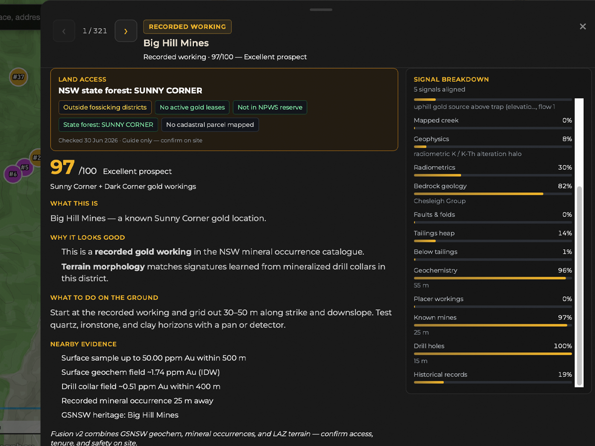
No other prospecting app in Australia does this. Not one.
The Honest Comparison
WE CHECKED OUT THE COMPETITION.
YOU SHOULD TOO.
While other prospecting tools do a good job with claims and basic mapping, and geology apps provide solid foundational layers, Dig Here was built to go further - combining everything serious prospectors actually need in one seamless platform.
Here’s how we stack up:
| Feature | Dig Here | Other Prospecting-Focused Apps | Other Geology-Focused Apps |
|---|---|---|---|
| Bare-earth LiDAR terrain | ✓ Included (no per-state or per-country fees) | Charge different fees per state | Not offered |
| Terrain analysis layers | ✓ 9 advanced layers (paleochannels, benches, workings detection, etc.) | Some layers offered | Basic shaded relief only |
| Drill hole assays with gold grades | ✓ 300,000+ (NSW & QLD now, but expanding) | Not offered (strong on surface geochemistry - 10M+ samples) | Limited (mainly WA) |
| Geophysics | ✓ Gravity, magnetics, radiometrics + mineral potential | Aeromagnetics / magnetics available | Aeromagnetics only |
| Prospectivity targeting | ✓ Ranked pins with plain-English explanations | Basic scoring/heatmaps only | Not offered |
| Land access & tenure | ✓ Per-pin detailed cadastral/tenure checks | Claim/tenement boundary layers | Tenement layers |
| Historic workings & leases | ✓ Included | Included | Included |
| Watercourses with flow direction | ✓ 2.5 million+ segments with downstream flow arrows, perennial/seasonal colour-coding, and per-stream detail popups | Not offered | Not offered |
| All-in-one platform depth | ✓ Deep fusion of terrain + drill + geophysics + fusion engine | Strong on claims & surface data | Strong on broad geology |
| Advanced terrain derivatives | ✓ Paleochannels, sky-view factor, local relief, openness layers | Some layers offered | Not offered |
| Field planning & reporting | ✓ Native iOS app with full offline maps including LiDAR, CarPlay, 3D flyover, compass navigation. GPS dig tracking, KML/GPX export, measurement tools. | Waypoints & offline maps | Trails & basic export |
Bare-earth LiDAR terrain
Terrain analysis layers
Drill hole assays with gold grades
Geophysics
Prospectivity targeting
Land access & tenure
Historic workings & leases
Watercourses with flow direction
All-in-one platform depth
Advanced terrain derivatives
Field planning & reporting
Comparison based on features and pricing publicly listed on competitor websites, August 2026. Check them yourself. We did.
At Dig Here, you get the complete picture - ultra-detailed terrain that reveals hidden ground, real drill results, richer geophysics, and prospectivity pins that tell you exactly where and why to dig.
Ready to prospect smarter?
See plans and pricing →Built For The Way You Prospect
PANNER, DETECTORIST,
OR FULL-BLOWN GOLD TRAGIC.
Free
The Weekend Fossicker
- ›Free terrain maps across Australia and New Zealand. 3D views to scout from the couch.
- ›75+ fossicking and gem sites with access conditions and directions.
- ›Satellite imagery (Mapbox and Google), base map controls, and fit-to-data views.
Fossicker
The Detectorist
- ›Ultra high resolution 1m LiDAR hillshade and all 9 terrain analysis layers.
- ›2.5 million+ watercourse segments with flow direction arrows. Perennial vs seasonal colour-coding highlights the dry gullies where alluvial gold hides.
- ›Drill assays, historic leases, and the measure tool to plan your grid.
Digger
The Serious Prospector
- ›Everything in Fossicker, plus Dig Here prospectivity pins that rank where 20+ datasets agree.
- ›Plain-English reasoning on every pin: what was found, why it matters, how to work it.
- ›Native iOS app with full offline maps including LiDAR. CarPlay navigation to your pins, 3D flyover, compass navigation, GPS dig tracking, unlimited waypoints, and KML/GPX export.
And so much more!
From Couch To Creek
PLAN IT AT HOME.
NAIL IT IN THE FIELD.
Research is only half the job. Dig Here turns your desktop scouting into a field plan you can carry into a total blackspot. The mobile app downloads every layer for offline use: LiDAR terrain, historic gold workings, 2.2 million+ drill assays, watercourses with flow direction, and land access. No mobile network needed. Everything works in full offline mode.
- ✓Full offline maps with every layer, including LiDAR
- ✓Historic workings, drill assays, watercourses, and land access offline
- ✓Private waypoints. Your spots stay yours.
- ✓KML/GPX export for Garmin and mobile GPS apps
- ✓GPS tracking to prospectivity pins and waypoints
- ✓Measure tools, 3D terrain, satellite hybrid views
- ✓Works on phone, tablet and desktop
Native iOS app. On the App Store now.
Full offline maps, LiDAR terrain, 3D flyover, compass navigation, GPS dig tracking and CarPlay. Everything you see on the website, right in your pocket. No extra cost. See what it does ↓

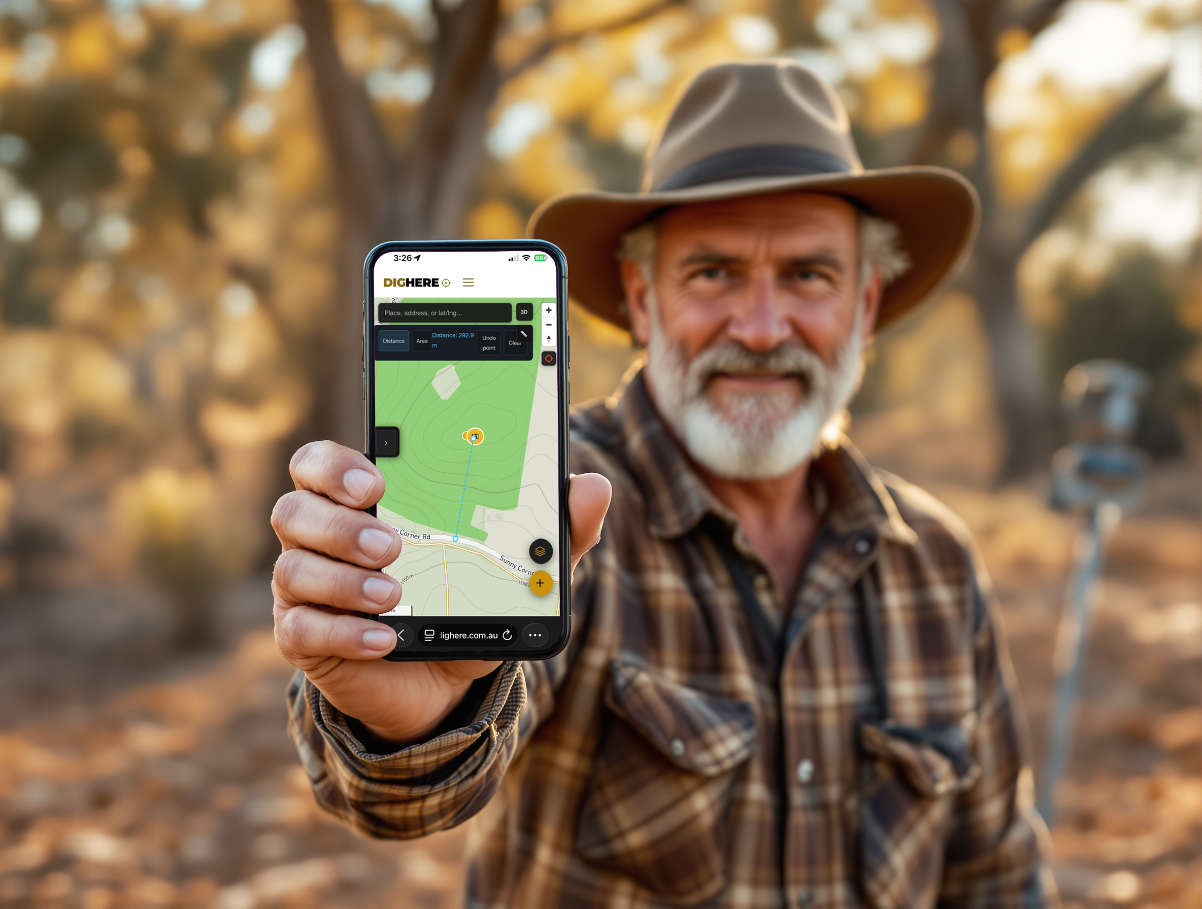
Now on the App Store
THE WHOLE GOLDFIELD
IN YOUR POCKET.
Everything you see on the website. In a native iOS app. With full offline maps including LiDAR, historic workings, drill assays, watercourses, and land access. Plus 3D flyover, compass navigation, GPS dig tracking, and CarPlay that drives you to the trailhead. Not a stripped-down mobile view. The real thing.
Whatever your plan unlocks on the web, you get on the app. Layers, pins, routes, and data sync automatically.
LiDAR in your hand
The same 1m bare-earth terrain data the pros use, draped over satellite or topo maps. So sharp you can spot 150-year-old diggings from the passenger seat.
No signal? No problem.
Save entire goldfields to your phone. Maps, satellite, LiDAR terrain, historic workings, drill assays, watercourses, and land access. Every layer works in a total blackspot.
CarPlay. The first prospecting app with it.
Tap a pin from the car screen and get routed straight there. It warns you where the road runs out and how far you will walk. A historic working comes into range and it asks if you want to divert. One tap. Drive-throughs become dig stops.
A compass that knows where the gold is
Pick a pin and the needle locks on: live distance, direction, and ETA as you walk. True-north corrected, so it agrees with the landscape, not just your fridge magnets.
Full 3D flyover
Stand at any spot - from the couch or in the field. Hold your phone up at a creek and see your pins and saved routes drawn on the ground around you. Planning tool and live field guide in one.
Track your digs
GPS records every step of the day. See exactly where you swung, not roughly, and review the trail on the website when you get home.
Pins, notes and photos. Both ways.
Drop a pin in the field with notes and photos and it is on your desktop before your boots are off. Build a route on the website and it is in the app when you head out. One 6-digit code links them.
Field-tough by design
Big gloves-on buttons, dark screen that does not kill night vision or battery, and zero reliance on reception once you are set up.
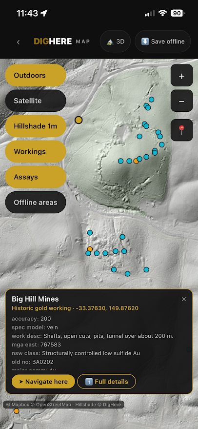
Available now on the App Store for iPhone, iPad and CarPlay. Android is on the roadmap. Included with every plan at no extra cost.
Do The Maths
ONE SUB-GRAM NUGGET
PAYS FOR A YEAR OF DIG HERE.
Gold is at record highs. Fuel isn’t cheap. Every wasted weekend on barren ground costs more than a year of the best data in the country. And unlike the other apps, your subscription includes the LiDAR. No per-state add-ons. No surprises.
Start free. Upgrade when you are ready for the full arsenal.
Simple, honest pricing
Find gold.
Not hidden fees.
Start free. Upgrade to choose your edge.
Free
Free
forever
- ✓ Base resolution terrain maps (AU, NZ, US, Canada)
- ✓ Gold workings + mining leases (AU and NZ)
- ✓ Land tenure (Australia and NZ)
- ✓ Satellite imagery (Mapbox)
- ✓ 3D terrain
- ✓ Measure tool
- ✓ Field-ready iOS app. Offline maps, LiDAR terrain, compass to your pins, and 3D flyover. No signal required (currently in beta - launching soon)
Fossicker
$12
per month
- ✓ Everything in Free
- ✓ HD resolution terrain maps (AU, NZ, US, Canada)
- ✓ Drill hole assays( NSW and QLD currently - other Aussie states soon)
- ✓ Watercourses with flow direction (Australia)
- ✓ Satellite imagery (Mapbox and Google)
- ✓ Up to 50 waypoints (pins) + KML/GPX export
- ✓ Fossicking & gemstone sites
- ✓ 10% shop discount (when it opens)
Digger
$29
per month
- ✓ Everything in Fossicker
- ✓ Ultra resolution terrain maps (parts of NSW now, more coming)
- ✓ Terrain analysis layers (parts of NSW now, more coming)
- ✓ Dig Here prospectivity pins with priority rank (parts of NSW now, more coming)
- ✓ Prospectivity evidence layers
- ✓ Plain-English geological reasoning
- ✓ 20+ dataset convergence scoring
- ✓ Field Intelligence for planning
- ✓ Unlimited waypoints + KML/GPX export
- ✓ GPS tracking to pins and waypoints
- ✓ PDF reports (20/month)
- ✓ 15% shop discount (when it opens)
All prices include GST.
THE EVIDENCE
IS WAITING.
The terrain. The assays. The history. The fusion engine.
All on one map. All pointing at the same spot.
Free plan available. No credit card required.