Warrego
FA4 - Near Tennant Creek - 47 km west from Tennant Creek
Location
Near Tennant Creek
Nearest Town
Tennant Creek
Distance
47 km west
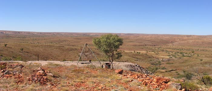
Photo: NT Government Department of Industry, Tourism and Trade
Location
Warrego is near the Tennant Creek region
Fossicking Area Boundary
Official declared boundary from the NT Government. You may only fossick within this area.
Boundary coordinates from NT Government gazettal
History
Exploration of the Warrego copper-bismuth-gold anomaly commenced in the late 1950s and operated up to late 1989, producing approximately 4.94 Mt of ore.
In addition to Warrego mine production, ores from other mines were trucked to the Warrego site for processing. They included ores from the White Devil, Gecko, Eldorado and Orlando mines.
The Tennant Creek operations, including the Warrego tailings storage facilities, are under care and maintenance with operation activities occurring in the area.
What You Can Find
Gold occurs in the surface soil and can be found by dry panning.
Metal detectors have been used successfully in the area.
Getting There
From Tennant Creek, follow the Stuart Highway 1.5 km north to the Warrego Road turnoff. Turn left towards Warrego and drive west along the bitumen road for 45.5 km to the signposted turnoff on the right.
Follow the track northwards for 13.8 km to an old mine, which is centrally located in the fossicking area.
This area is accessible by conventional vehicles, as the track is well-formed dirt and gravel.
Be aware of the railway line passing through this fossicking area. Stay clear of the railway corridor.
The fossicking area lies within Phillip Creek pastoral lease. Care should be taken not to interfere with the movement of cattle or other station activities.
Camping
Bush camping is allowed, however there are no facilities on site.
Campers must provide their own water as the bore and tanks in the area are no longer serviceable.
Campers must take their rubbish with them when they leave.
Source: NT Government DITT, CC BY 4.0