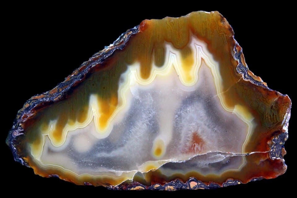
Agate Creek
Georgetown district - 85 km south from Georgetown
Location
Georgetown district
Nearest Town
Georgetown
Distance
85 km south
Photo: Lech Darski / Wikimedia Commons (CC BY-SA 4.0)
Location
Agate Creek is near Georgetown
Fossicking Area Boundary
Official declared boundary from the Queensland Government. You may only fossick within this area.
Boundary data from Queensland Government spatial services
History
Agate Creek is one of Queensland's most famous fossicking destinations, renowned for the quality and variety of its agate. The creek cuts through ancient volcanic rocks that have produced agate nodules, thundereggs, jasper, and chalcedony in spectacular colours.
The area has been popular with rock collectors and fossickers since the mid-20th century. The remote location and rugged terrain add to the adventure, and the creek itself is a beautiful spot in the dry season.
What You Can Find
Banded agate in a wide range of colours is the main attraction. Some specimens show exceptional translucency and pattern.
Thundereggs, jasper, and chalcedony are also found along the creek and in the surrounding volcanic country.
Agate is found as loose nodules in the creek bed and in the surrounding country. Walking the creek is the main fossicking method.
Getting There
From Georgetown, head south on the road towards Forsyth. The Agate Creek turn-off is approximately 70 km south, then follow tracks to the creek.
A 4WD is essential. The final section of track is rough and can be impassable after rain. Do not attempt in the wet season.
Georgetown is approximately 290 km west of Cairns via the Gulf Development Road.
Camping
Bush camping is available at Agate Creek. There are no facilities. Carry all water, food, and fuel.
The nearest services are in Georgetown.
Important Notes
- !The area is very remote. Mobile reception is non-existent. Carry a satellite phone or PLB.
- !Best visited in the dry season (May to October). The creek may flood in the wet season.
- !Snakes and other wildlife are common. Take appropriate precautions.
View Agate Creek on the Map
See satellite imagery, terrain, and surrounding fossicking areas.
Open MapSource: Queensland Government