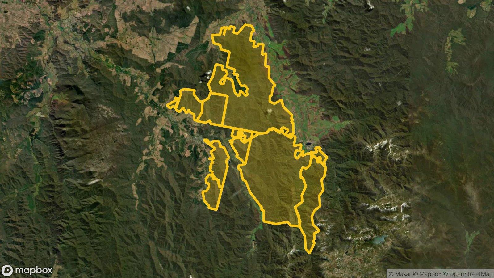
Mount Beauty-Bright State Forest
Over 37,000 ha of State forest in blocks between Bright and Mount Beauty, open with a Miner's Right. The block on the ridge between Bright and Wandiligong holds 93 of the 95 recorded old workings inside the forest.
Land
State forest
Nearest town
Bright
Distance
Starts about 1.5 km east of town
Old workings inside
95
Satellite: Mapbox, Maxar. Boundary: DEECA
Location
Mount Beauty-Bright State Forest is near the Bright region
Fossicking Area Boundary
Official declared boundary from the NT Government. You may only fossick within this area.
Boundary coordinates from NT Government gazettal
Can you prospect here?
- !State forest: prospecting is allowed with a current Miner's Right and hand tools.
- !The Ovens River, the Buckland River, Morses Creek, the Buffalo River and the Kiewa River are on the banned list. Don't fossick in them. Our map also shows the river frontage reserves along banned rivers as NO.
- !The pine plantations around Bright and Porepunkah are not State forest. They are run by HVP Plantations and need their permission.
- !Mount Buffalo National Park, next door, is closed to prospecting.
- !A small part of the forest is under a granted mining licence (MIN4004, about 8 ha), where you need the holder's permission. Exploration licences and applications cover a good part of the rest; those don't stop you with a Miner's Right, but stay clear of any drilling or work sites.
- !Relics and historic mine sites are protected under the Heritage Act. Don't disturb them.
Banned waterways here: Ovens River, Buckland River, Morses Creek, Buffalo River, Kiewa River. Victoria bans prospecting in these rivers and creeks. Full list.
Mining and exploration licences can sit over any of this ground. On the Dig Here map, turn on Land tenure and Current leases and tap the spot: you get a straight YES or NO, and the titles update every Sunday.
History
Gold was found near where Morses Creek meets the Ovens River by 1856, and Bright was surveyed as a township in 1862. Reef mining kept the town going through the 1860s, and bucket dredges worked the valley floors until 1922.
Up Morses Creek, gold was found where it meets Growlers Creek between 1856 and 1858. The settlement was called Growlers Creek until it was renamed Wandiligong in 1872, and it lived off its reefs into the 1900s.
Over the range in the Buckland Valley, Chinese miners far outnumbered Europeans by 1857. On 4 July 1857 a mob of European miners attacked the Chinese camps, destroyed their tents and their joss house, and drove them across the Buckland River. The crossing is now on the Victorian Heritage Register as a place of remembrance.
Where to look
The block on the ridge east of Bright and Wandiligong is the old reef country. Our workings layer shows 93 recorded workings inside it, including the Home To Dinner, Morning Star, Railway, Williams and Ganders reefs and the Long Tunnel mine. The other blocks have almost none recorded, so they are less proven ground.
Dig Here Pins (on the Digger plan) cover the Bright goldfield, and Hot Ground works here too. Tap each spot: some of the forest has mining titles over it.
Old shafts and adits are still open in places. Keep well clear of them, and leave old mine relics where they are.
Getting there
Bright is on the Great Alpine Road, about 80 km south-east of Wangaratta. The main gold block rises straight up from the east side of Bright and Wandiligong.
Forest roads and tracks can close for bushfire risk, timber work or wet weather, and many high-country tracks close each winter, roughly from the June long weekend to the end of October. Check ffm.vic.gov.au/forest-and-road-closures before you go.
Camping
Check Forest Fire Management Victoria (ffm.vic.gov.au) for camping in the forest and for fire bans. Bright has caravan parks and plenty of accommodation.
See Mount Beauty-Bright State Forest on the map
Old workings, flow direction on every creek, mining titles and a YES or NO for any spot.
Open the mapMore in The North-East
Rules: Resources Victoria and Parks Victoria, checked 6 Nov 2026. Boundaries: DEECA Public Land and Parks. Always check before you go.